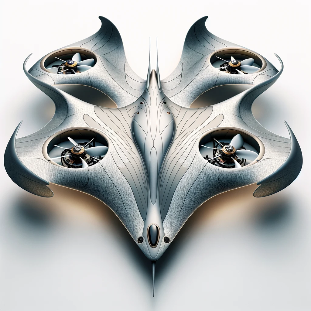
Concept design of Stingray X10
Stingray X10
Mapping and Surveying
Inspired by the stingray in shape and form this drone is not only beautiful but comes with a full arsenal of capabilities
Equipped with GPS and mapping software the Stingray X10 can create high-resolution 3D maps, terrain models, and orthomosaics.
The Stingray X10 can streamline land surveying, urban planning, and environmental mapping tasks, providing accurate geospatial data for various applications.
Concept design of Skywhale X10
Skywhale X10
Environmental Monitoring
Inspired by the largest creature that ever lived on earth, the Skywhale X10 is equally a technology giant.
The Skywhale X10 focus on providing valuable data for conservation efforts, ecological research, and wildlife management, aiding in environmental protection and sustainability.
With built in sensors it can monitor environmental parameters such as air and water quality, wildlife habitats, and deforestation.
As whales in the real world communicate and work together, the Skywhale has built in technology for working together in large numbers and share data autonomously.
Piranha X10
Security and Surveillance
Small but fearless.
Our security and surveillance capable drones are equipped with special cameras, sensors, and AI-powered analytics to enhance security and surveillance operations for critical infrastructure, events, and public spaces.
The Piranha X10 offer real-time monitoring, threat detection, and rapid response capabilities, improving overall safety and security.
Main features also include infrared vision, facial recognition and autonomous tracking of individuals and objects.